Commercial drone services have moved well beyond simple aerial photography. Today, many organizations need more than a dramatic overhead image for a website or brochure. They need specialized visual tools that can help them assess conditions, document assets, support planning, and communicate complex information more clearly. That is exactly why LiDAR and thermal FLIR infrared drone services have become increasingly important for businesses and institutions across the St. Louis area.
At St Louis Commercial Photographers, we view advanced drone imaging as a practical business resource as much as a creative service. The right drone technology can do far more than capture a nice-looking shot. It can help reveal site conditions, support inspections, improve project documentation, and generate visual assets that serve both operational and marketing goals.
For decision makers responsible for commercial properties, construction projects, facilities, infrastructure, industrial sites, and brand communications, that added value matters.
The shift from aerial visuals to aerial insight
A standard drone camera is excellent for broad site views, exterior overviews, promotional footage, and general documentation. But some assignments demand more than what the visible spectrum can provide. Businesses often need information that helps them better understand a site, a structure, or a system.
That is where LiDAR and thermal infrared imaging come in.
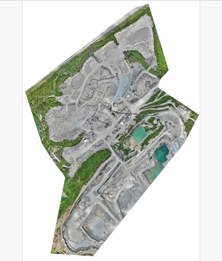
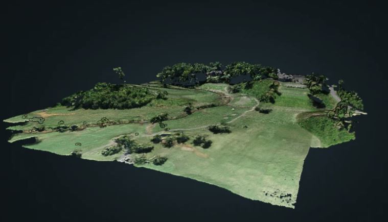
LiDAR allows for highly detailed spatial capture, helping create a much more accurate picture of topography, contours, elevations, and physical layouts.
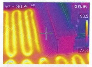
Thermal FLIR infrared imaging identifies differences in surface temperature, which can help reveal patterns or anomalies not visible in normal light.
These are different technologies with different uses, but both expand what a drone project can accomplish.
Why LiDAR matters for commercial imaging
LiDAR, or Light Detection and Ranging, uses laser pulses to measure surfaces and distances with a high degree of precision. From that information, detailed spatial models and point cloud data can be created. For many commercial projects, that means a better understanding of how land, structures, or large properties are physically organized.
This type of imaging can be especially useful in situations where ordinary photography does not provide enough depth. A conventional image may show the appearance of a site, but LiDAR can help define its shape and layout in a much more analytical way.
That makes it a strong option for projects involving:
construction and development sites
industrial and manufacturing properties
large business campuses
infrastructure corridors
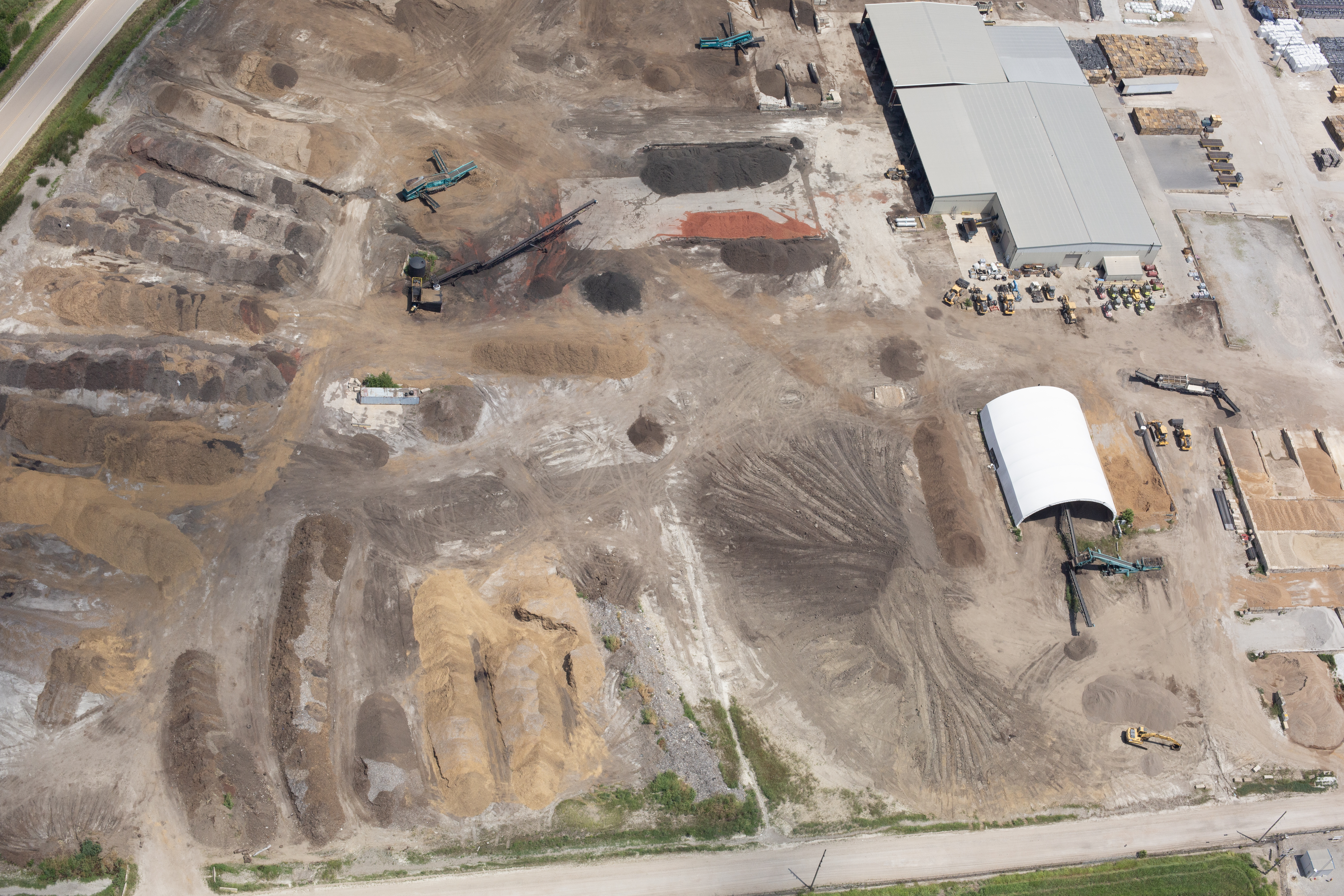
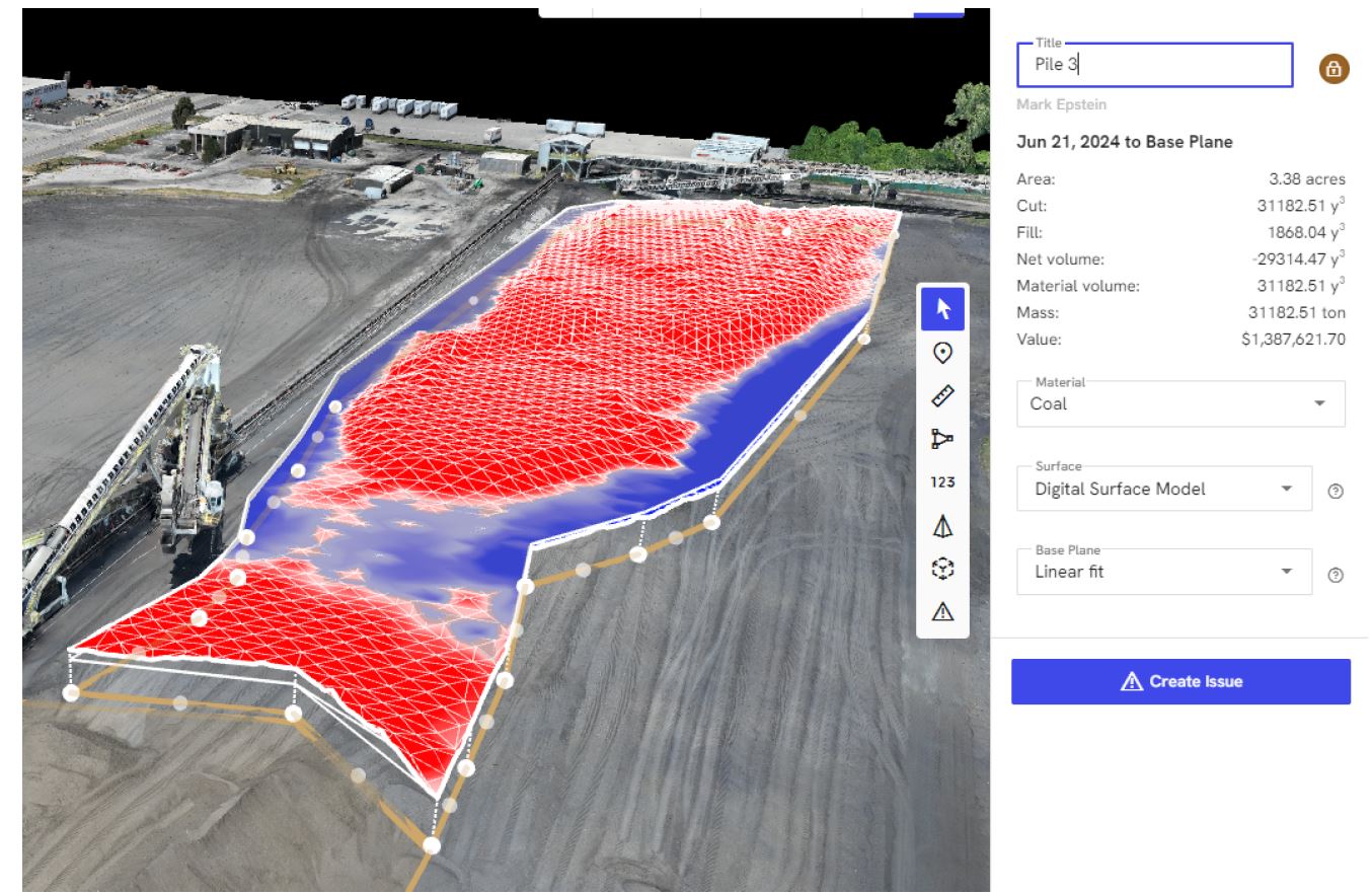
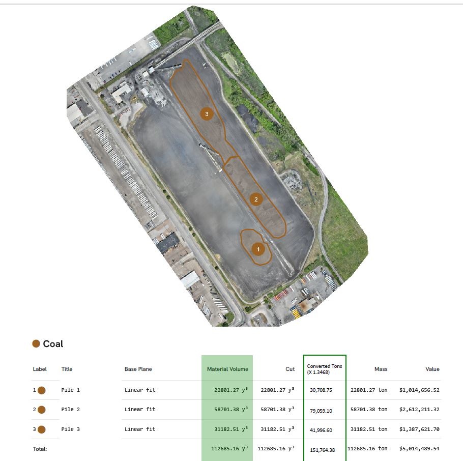
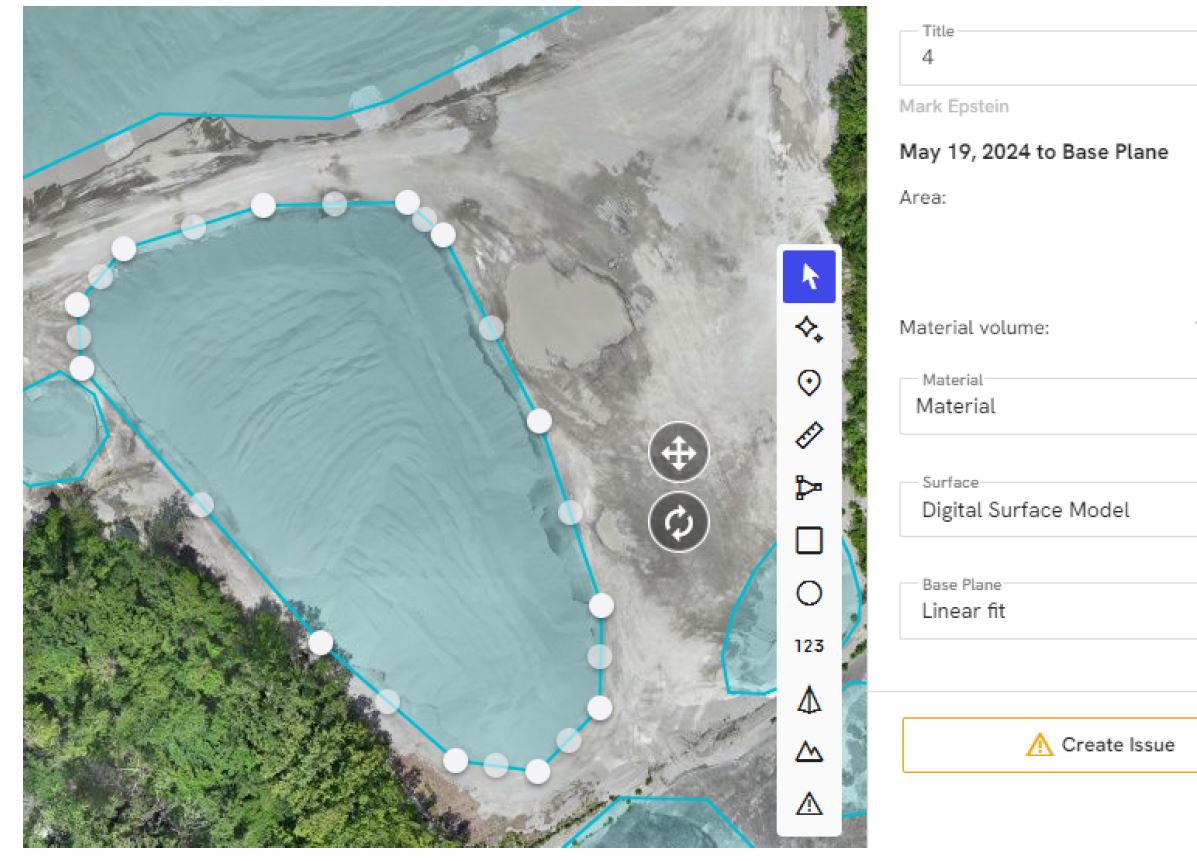
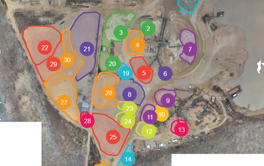
outdoor storage and stockpile environments
institutional properties
land planning and site analysis
For clients managing large-scale environments, LiDAR can improve documentation and provide a more meaningful visual foundation for planning and communication.
What thermal FLIR infrared drone imaging contributes
Thermal imaging serves a completely different role. Rather than measuring shape and position, it visualizes heat.
A thermal-equipped drone can help identify temperature differences across roofs, building exteriors, mechanical areas, electrical zones, solar arrays, and industrial assets. This can be valuable when a client needs a broader, faster way to review large or difficult-to-access areas.
For example, a roof may appear normal in standard aerial photography but show uneven temperature patterns in infrared. A building facade may reveal signs of heat loss that are not otherwise obvious. A mechanical or utility area may display hotspots that suggest the need for closer professional evaluation.
Thermal imaging is especially useful because it can help organizations direct attention more efficiently. It does not replace qualified specialists in roofing, engineering, electrical systems, HVAC, or building science. But it can provide stronger visual evidence to support further investigation.
A strong fit for St. Louis commercial clients
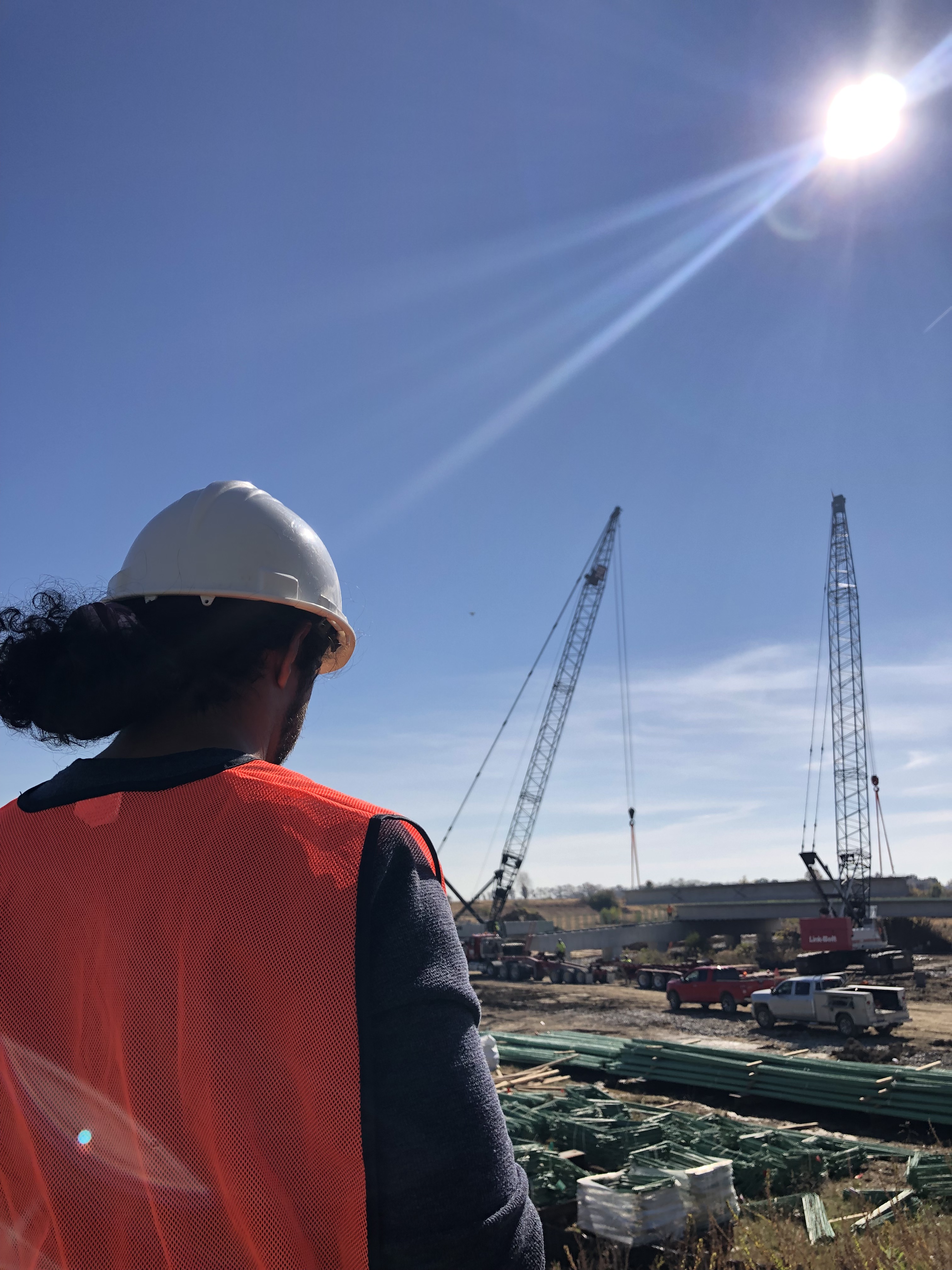
The St. Louis region includes a wide range of environments where advanced drone imaging can provide real business value. Warehouses, healthcare campuses, manufacturing facilities, schools, retail centers, industrial parks, corporate buildings, infrastructure projects, and active construction sites all benefit from better visibility.
These properties are often too large, too complex, or too difficult to fully understand from ground level alone.
That is why LiDAR and thermal services are increasingly relevant. They help clients see more of the site, understand more of the conditions, and communicate more effectively with stakeholders, leadership teams, consultants, and customers.
For agencies and marketing departments, these tools also create distinctive visual assets that help communicate sophistication, scale, and technical capability.
Understanding the difference between LiDAR and thermal imaging
Although these services are often grouped together, they are designed to solve different problems.
LiDAR focuses on spatial accuracy, terrain, elevation, geometry, and detailed physical layout.
Thermal infrared imaging focuses on heat variation, temperature behavior, and the detection of unusual thermal patterns.
A project that requires site mapping or a clearer understanding of land contours may benefit from LiDAR.

A project involving a commercial roof, building envelope, solar system, or industrial equipment may benefit more from thermal capture.
Sometimes both technologies can be useful on the same assignment. Sometimes only one is needed. The most effective solution depends on the purpose of the shoot and the intended deliverables.
Commercial applications for LiDAR drone services
LiDAR becomes particularly useful when a client needs more than a surface-level visual record.
Construction teams often benefit from improved site documentation and a clearer sense of grade and terrain.
Developers may need better site awareness for planning, presentations, and pre-construction analysis.
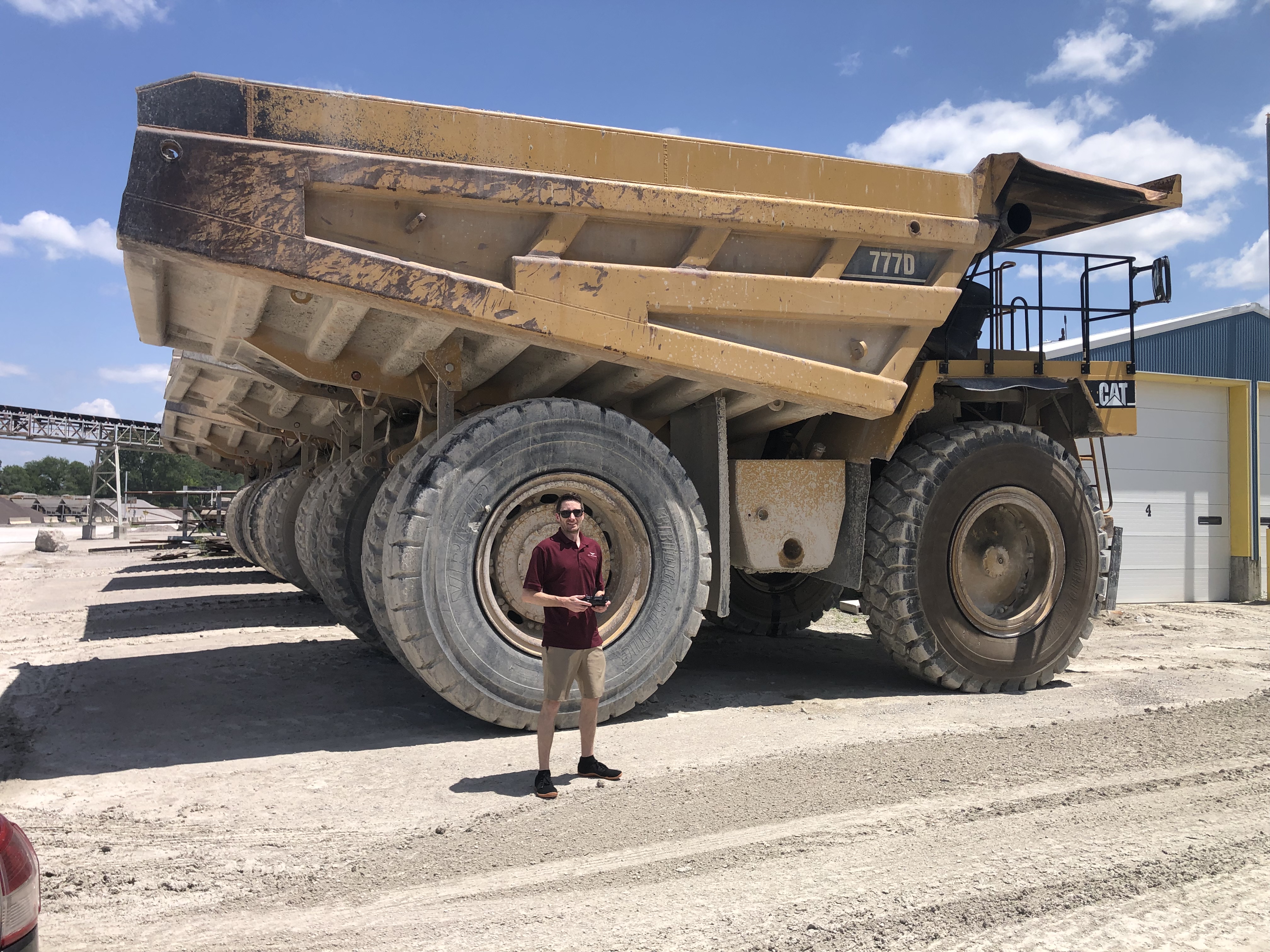
Industrial clients may want a more comprehensive view of large yards, facilities, and access routes.
Stockpile and aggregate environments may use LiDAR-oriented workflows where volume and surface shape are important considerations.
Large campuses and institutional properties can also benefit from a more detailed understanding of site relationships and physical organization.
In all of these cases, LiDAR adds a layer of measurable perspective that goes far beyond conventional aerial imagery.
Commercial applications for thermal drone imaging
Thermal FLIR infrared services are especially valuable when clients need to review large areas quickly for possible irregularities.
Commercial roofing is one of the best-known examples. Infrared imaging can help identify temperature differences across wide roof surfaces that may indicate areas worth closer examination.
Building envelope reviews are another strong use case. Thermal imagery can help show heat transfer patterns that may raise questions about insulation, air leakage, or material performance.
Solar panel systems can also be screened thermally to reveal unusual heat signatures that may point to underperforming components.
Industrial and facility operations may use thermal drone services to observe large-scale systems or structures where abnormal heat patterns can help guide maintenance priorities.
This kind of imaging can be especially useful when organizations want a broad visual screening tool that is more efficient than inspecting every area from the ground.
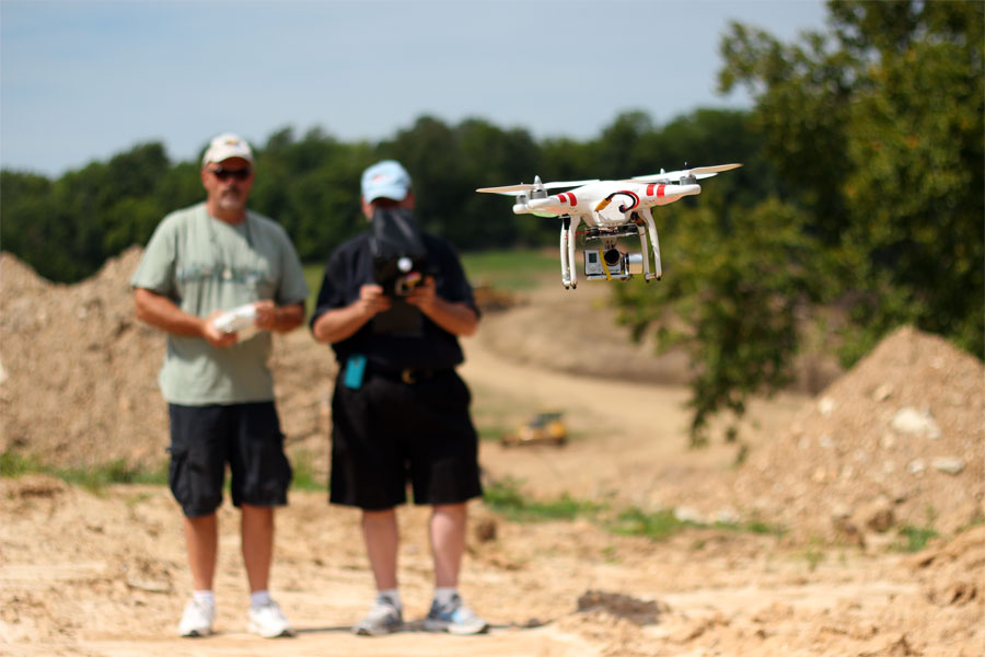
Why advanced drone services require more than flying skill
One of the biggest mistakes businesses can make is assuming all drone services are essentially the same. They are not.
Advanced imaging assignments require a different level of planning, awareness, and execution. Thermal flights, for instance, can be affected by environmental conditions, recent weather, sunlight, materials, and timing. LiDAR assignments depend on proper mission planning, altitude, coverage design, and output needs.
The final results are shaped as much by the planning process as by the equipment itself.
That is why commercial clients should look for a provider that understands production, logistics, safety, deliverables, and location management. Capturing useful advanced imagery is not just about getting airborne. It is about knowing what to capture, how to capture it, and how to organize it for real-world use.
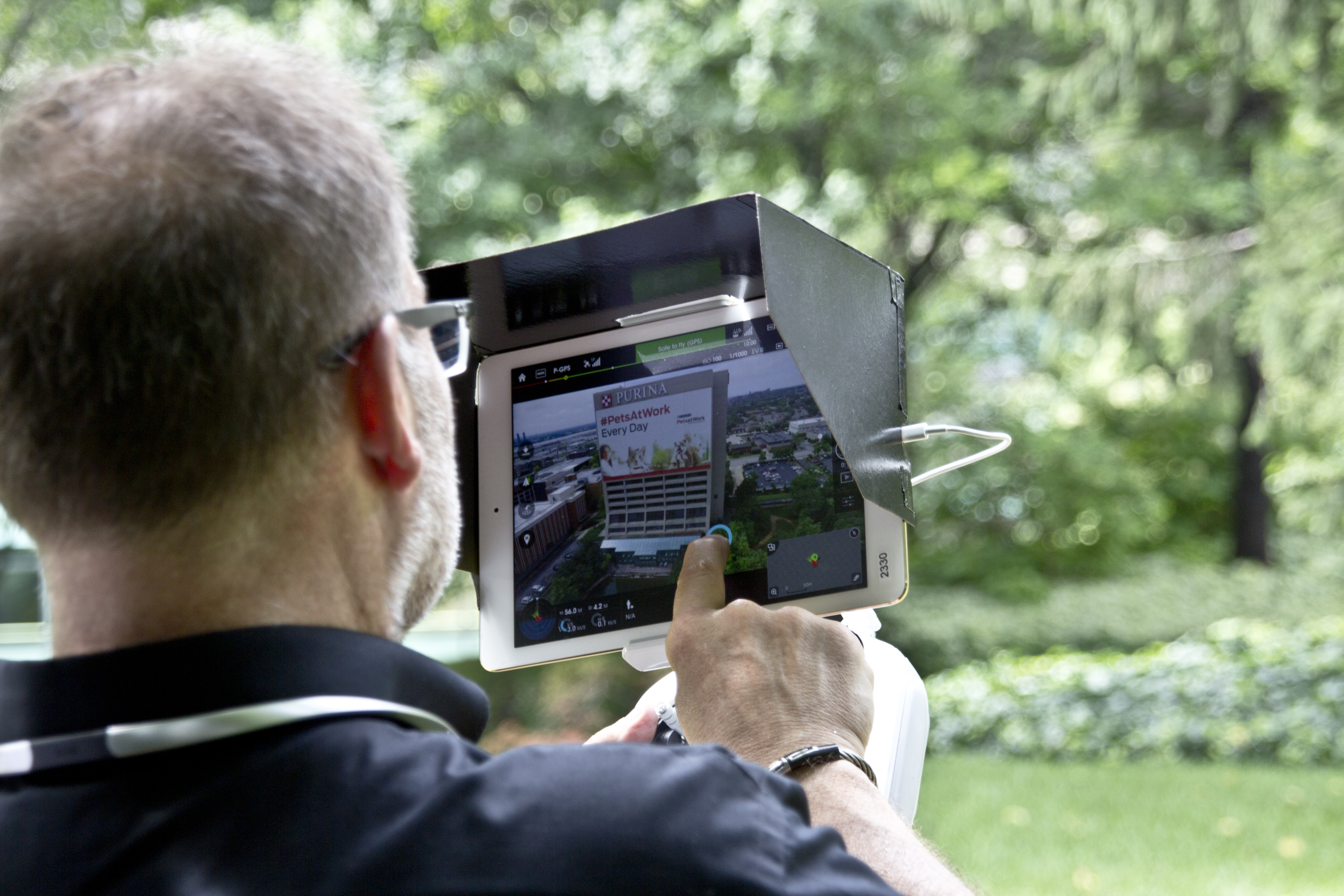
The communication value of technical imagery
Advanced drone imaging is not only useful for inspections and documentation. It also has major communication value.
LiDAR and thermal visuals can strengthen proposals, support reports, improve presentations, clarify conditions for stakeholders, and enhance case studies. For businesses that want to show innovation and technical capability, these assets can also become strong marketing tools.
This is especially true when the drone work is handled by a team with broader photography and video production experience. A full-service production company can help clients do more with the material by shaping it into polished, purposeful visual content.
That means the same assignment can often support both technical and promotional needs.
A broader standard for image acquisition
Modern commercial clients increasingly expect their visual content to do more than look good. They want photography and video that provide practical value, support decision-making, and improve communication.
LiDAR and thermal infrared drone services fit that expectation perfectly. They offer a more informative kind of aerial imaging, helping organizations better understand their sites, buildings, and systems.
For businesses in St. Louis, these technologies can provide a smarter way to document and communicate what is happening on the ground, on the roof, across the property, or throughout a project lifecycle.
St Louis Commercial Photographers for LiDAR and Thermal FLIR Infrared Drone Services
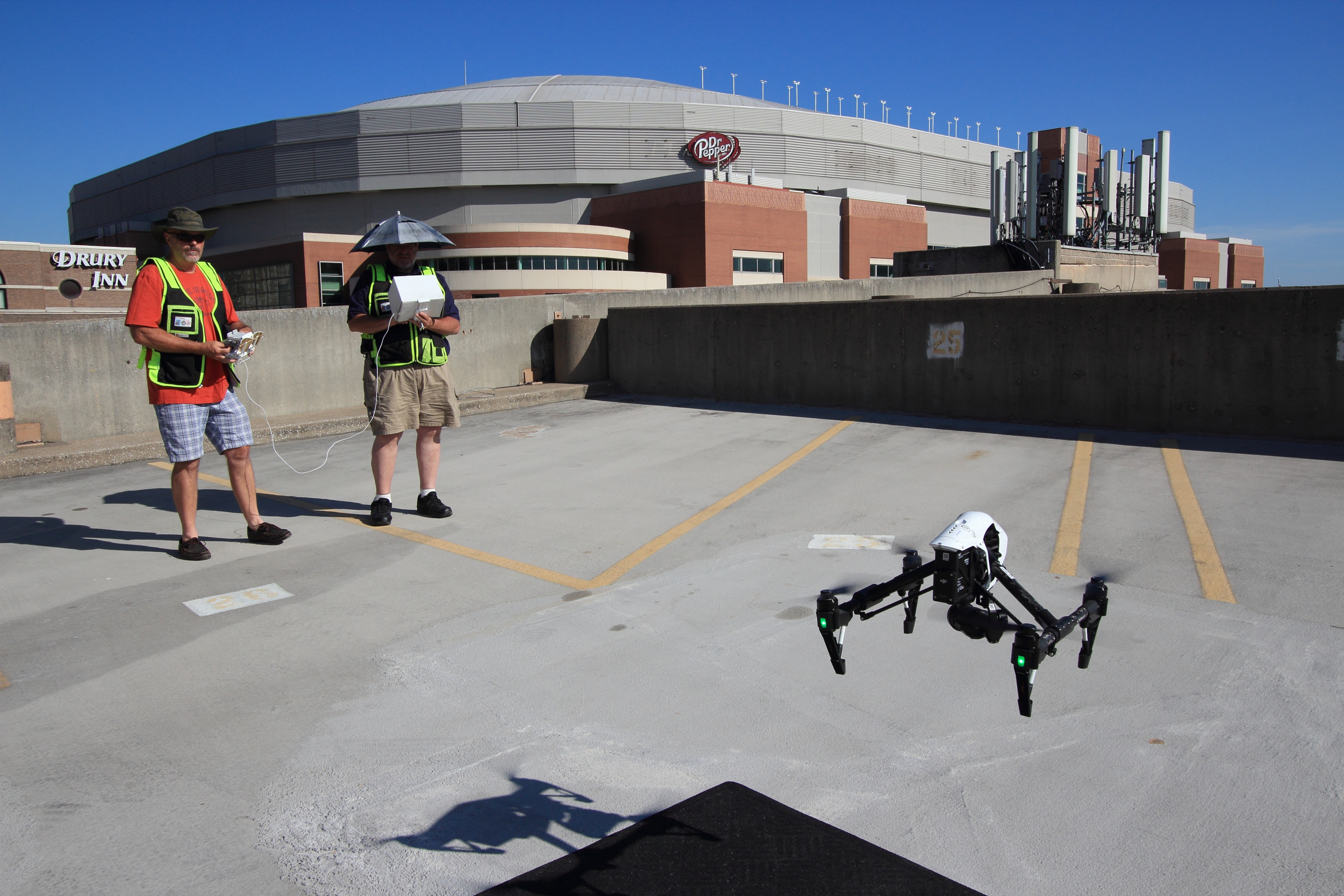
At St Louis Commercial Photographers, we bring a commercial production mindset to every advanced drone assignment. We understand that clients need more than attractive footage. They need imagery that supports business goals, whether those goals involve documentation, assessment, planning, communication, or marketing.
St Louis Commercial Photographers is a full-service professional commercial photography and video production company with the right equipment and creative crew service experience for successful image acquisition. We offer full-service studio and location video and photography, as well as editing, post-production and licensed drone services. St Louis Commercial Photographers can customize your productions for diverse types of media requirements. Repurposing your photography and video branding to gain more traction is another specialty.
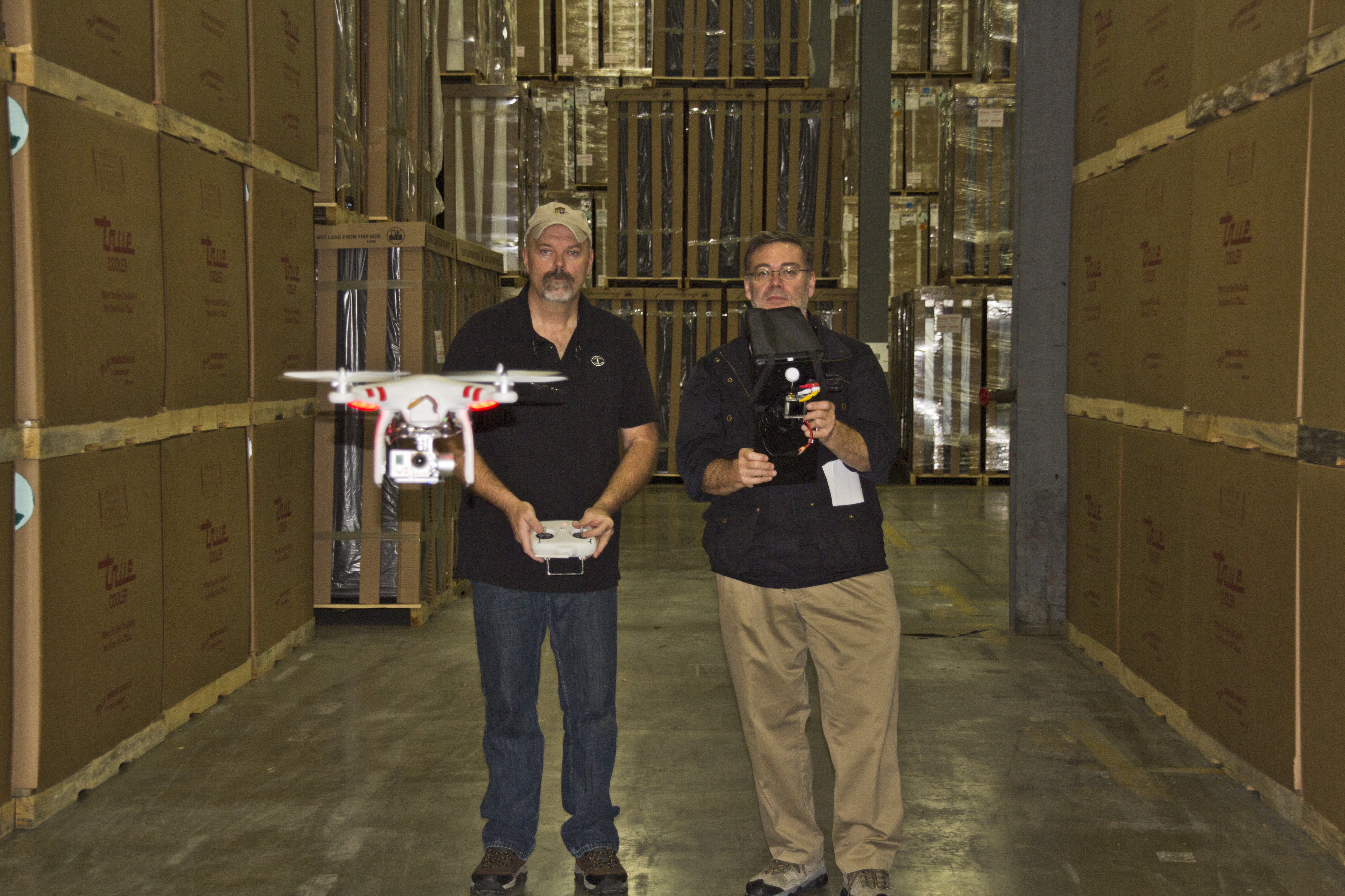
We are well-versed in all file types and styles of media and accompanying software. We use the latest in Artificial Intelligence for all our media services. Our private studio lighting and visual setup is perfect for small productions and interview scenes. Our studio is large enough to incorporate props to round out your set. We support every aspect of your production—from setting up a private, custom interview studio to supplying professional sound and camera operators, as well as providing the right equipment—ensuring your next video production is seamless and successful. We can fly our specialized drones indoors.
Since 1982, St Louis Commercial Photographers has worked with many businesses, marketing firms, and creative agencies in the St. Louis area for their marketing photography and video. When clients need advanced aerial imaging backed by real production experience, we provide the visual expertise, technical capability, and professional support required to get the job done right.
